For reservations klick here (only visible after login)
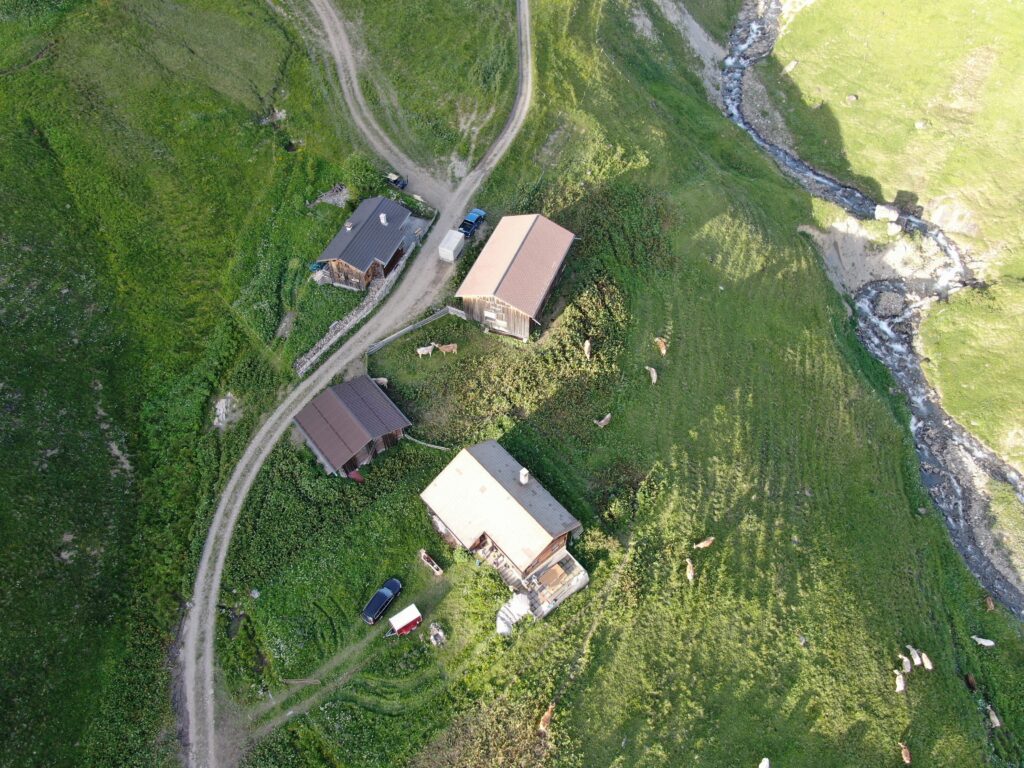
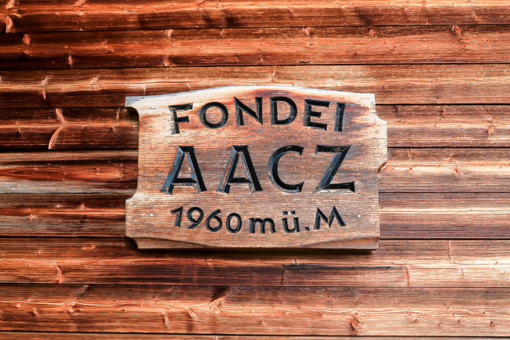
After the tragic death of Heinrich Spoerry on the Matterhorn in August 1907 the club received a donation for the procurement of another hut. In the end it needed 16 years and many discussions about the locations like Neuvaztal, Laquinthal, Lauteraarjoch, Trugberg, Silberlücke and very detailed about Sellapass. After it was almost decided to procure Sciorahut in 1920, the club found a beautiful Walser-hut high up in the Fondei valley next to the epicenter of alpine skiing at that time. Thus, since 1924 we are proud owners of this beautiful small hut.
In 2024 we celebrated the 100th anniversary of our hut. In this context, Walter Giger and Hans Wäsle published a small chronicle which can be downloaded here:
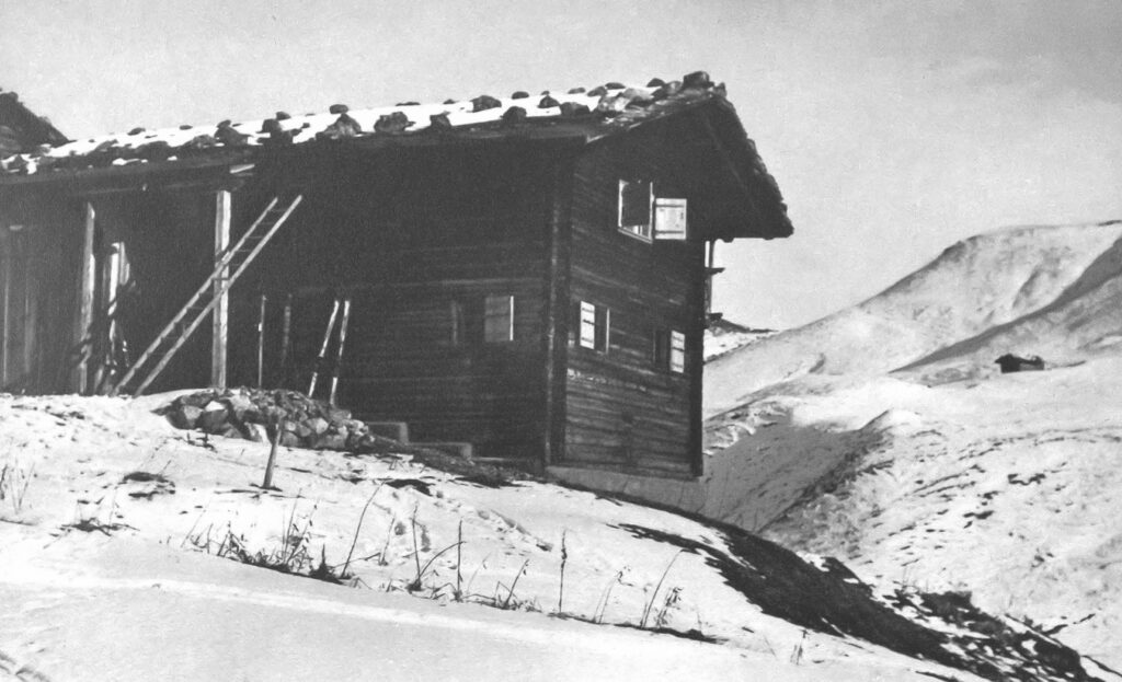
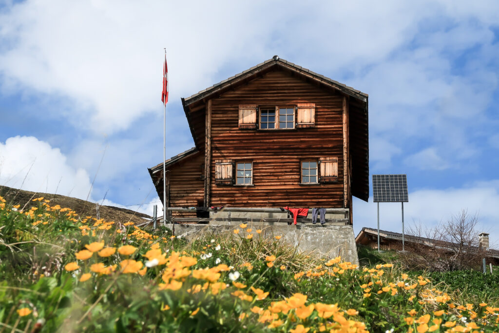
For many decades that hut was used for a lot of skitours, celebrations and other events. After New Year 1971 the hut burnt down to the ground but was immediately rebuilt.
The cosy hut hosts a maximum of 28 guests and is privately and exclusively owned by the club. Club members can find more details about the hut and reservation here (only visible, if you have signed in).
Tour Suggestions
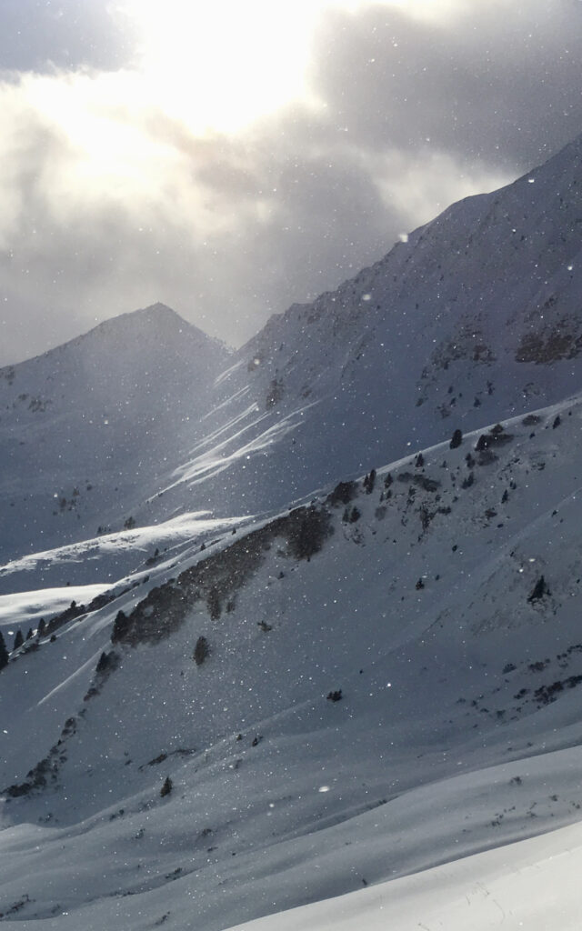
Skitouring
I won’t write anything about Skitouring. The slopes around our hut simply offer too many great options!
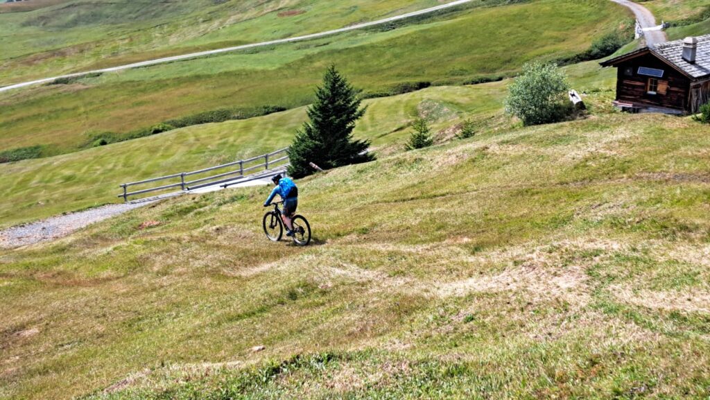
Mountainbiking
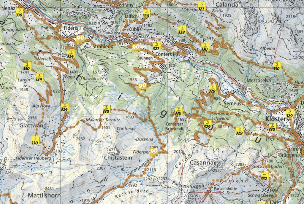
The Durannapass is very popular among mountain bikers. Below you can find a few more tips:
Ascents
- Classic route from Langwies via the road (you gain 2/3 of the elevation gain right at the beginning on 1/3 of the route)
- From Klosters via routes 330 and 631 (although you’ll have to push a lot between Conterser Schwendi and Hohensäss – unless you’re extremely fit)
- Via route 90 from Küblis (also suitable for gravel bikes, as Valerie and Karsten demonstrated at the hut’s 100th anniversary celebration)
Descents
- To Klosters via routes 631 and 330
- Via the old summer trail to Langwies
- Highly recommended for scenic views is the high-altitude trail (part of route 330) from the Duranna Pass to the Heuberge Mountains.
- From the Heuberge Mountains, you can either descend into the Prättigau, preferably via route 330 or in combination with route 324, although route 324 is probably better for mountain bikers anyway. is too boring
- A real highlight is the descent via Arflinafurga to Chur!
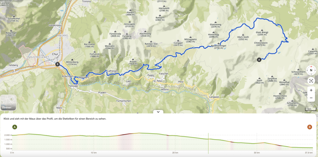
Via Arflinafurgga to Chur
Tested by Andreas and Hans.
We are starting to climb towards the Durannapass and follow the high-altitude trail Route 330 to the Heuberge. From there, we climb steeply (sometimes pushing) to the Arflinafurgga. Now, don’t rely on the Komoot routes (which take you along standard gravel routes), but keep your eyes open and look for hiking trails. You reach Castiel via the Fanin Pass, Skihaus Hochwang, and Faschatz, through the Clasaurer Tobel. From there, follow the road briefly, but after the Calfreiser Tobel (the tunnel can be bypassed via the closed path (attention: rockfall!), you can turn off to Maladars. A final trail leads you through the Speinis to Meiersboden. An approximately 850-meter ascent awaits you, followed by a 2000-meter descent to Chur.
(GPX track can be provided by Hans)
Summit Destinations and Alpine Hikes
Everyone knows the obvious tours like Mattjischhorn, Strassberger Furggeli, Stelli, etc. But the area is also ideal for off-trail tours. Below, I’ve listed three of my favorite tours.
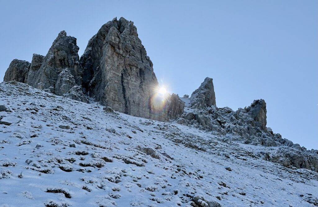
Zenjiflue (2686 m) via the western gully
Climb off-trail to the bottom of the rock face. After a short scramble, below the sun on the right in the photo, the trail leads directly to the summit through some loose scree. For the descent, the route from Schwerzi (spectacular scenery) to the north is recommended.
.
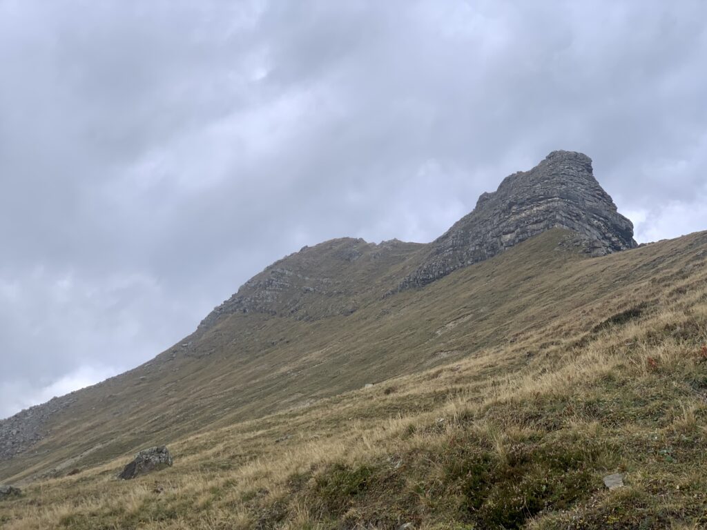
Chistenstein (2473 m) Traverse via South Slope
Off-trail to the rocks of the Chistenstein eastern spur (to the ridge of the Drimarchaspitze). Along the rock face towards the west and then directly through the steep grassy crags of the south slope.
Descent via the normal route. Those who wish can then also continue off-trail to Piz Fondei (2430 m without a name on the map).
.
Seehorn (2282 m) via the west ridge
From the Grünsee, the trail leads across grassy slopes to the rocks. An easy scramble leads directly to the summit. Descend via the north slope directly to the Grünsee.
.


(Movie and Pictures by Franz Koch)


(Pictures by H. Wäsle and M. Hood)